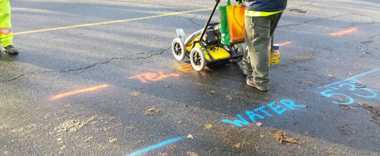
Detection of the location of underground installations, in accordance with the terrain conditions, implies various technologies that can be applied: geophysical detection methods (geomagnetic and GPR method) and electromagnetic method of underground installation detection. Application of these methods and interpretation of the acquired results enable very good location positioning using detection of signals that originate from various materials in the underground installations.
In the past, numerous underground installations have been laid without previous geodetic survey and input of data into the Utility Cadastre. Continuous changes of the environment and the population number give rise to a need for construction of several facilities or rehabilitation of the existing facilities. Infrastructure, and especially utility lines, have to be maintained continuously. The main challenge for the changes is the lack of knowledge on the precise position of the underground installations. If the location of the utility lines is unknown, it is not possible to design the utility network. This gives rise to a need for detection and mapping of the utility lines. Quality of detection and mapping is very important. In case the location of the utility line is misdetermined, or if the utility line cannot be detected, serious accidents and damages might occur. In order to protect people and equipment, quality of detection and mapping of underground utility lines must be assured. Any excavation can inevitably lead the construction workers close to underground installations (power lines, gas pipeline, telecommunication lines, water supply system, etc.). In order to avoid such issues, during the construction of a facility, it is necessary to determine and map the position of the future utility line in detail.
Detection and identification of underground installations have become critical functions done before any other works. As our infrastructure network grows, the density of cables, pipelines and other installations grows as well. In many cases, these information have been gathered, but they haven’t been saved or they are not available.
For each placed installation, it is necessary to perform geodetic survey, based on which a study of geodetic works for underground installations is produced and then submitted to the competent Service for utilities cadastre. On that occasion, the Utility Cadastre is obliged to issue a certificate of the surveyed utility line. Discovery of underground utility lines is done using a locator, by excavation and by both.
Locator is a hand-held instrument capable of detecting a wide range of frequencies, showing underground electric cables and telecommunication cables. Using the instrument, the surveyed area is shown as a grid and all “live” cables are mapped using the instrument’s display and tone produced as an indication. The instrument detects cables at the angle of 90o, thus indicating the direction in which the detected utility lines have been placed.
Metal utility lines or non-loaded cables can be detected by a signal generator. Direct use of signal transmitter implies attaching a signal transmitter to the utility line that needs to be measured. Signal generator then induces a signal directly to the utility line, thus enabling tracking of the underground utility lines route. When signal transmitter is used indirectly, operator sends the signal in the ground. This induces frequencies on utility lines capable of producing a signal. Using an instrument for cable detection, these utility lines can be located if they resonate or carry the emitted signal. In any case, it is important to locate the starting point of an utility line.